 Software
Magnetic Correction
The magnetic correction module in Horin Software is completely designed in accordance with industry standards.
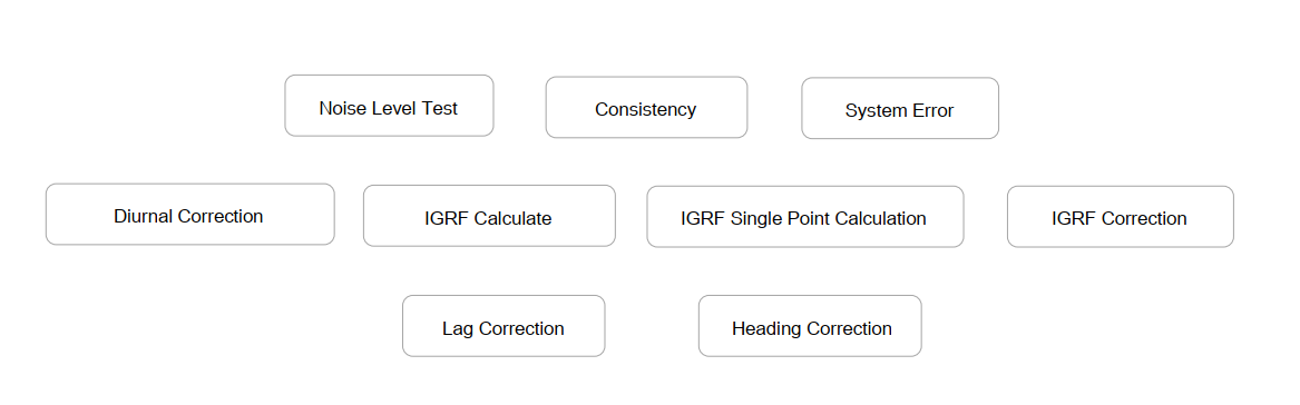
It contains 9 functions:
The ocean magnetic correction series function is a professional module customized by Horin Company for marine survey.
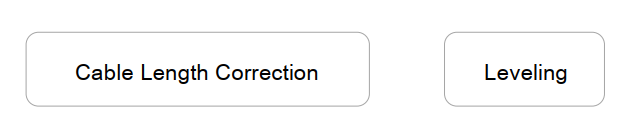
It contains 2 functions:
Magnetic Correction
Instrumentation Determination
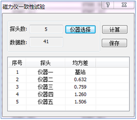
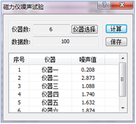
In the magnetic survey, the noise of the instrument, the consistency of all probes and the system error of the instrument need to be measured, and ensure they meet the using standards before the survey work.
-18ece9e5-f270-4650-af66-364b923e5b23.png)
Consistency Noise level determination System error determination
IGRF Reduction
IGRF (International Geomagnetic Reference Field) is a model related to the Earth's main magnetic field and secular variation. The geomagnetic reference field is a background field that needs to be removed when performing magnetic work. Internationally, the geomagnetic field spherical harmonic analysis model is used to represent the basic magnetic field of the earth. It is called the International Geomagnetic Reference Field, and its model coefficient is adjusted every five years, and the age of reference field is marked. You can remove the Earth's background magnetic field by the IGRF reduction Horin Software include the latest IGRF13 model released in 2020.
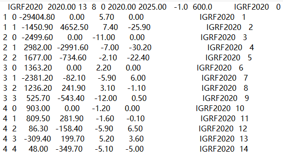

Horin Software uses the latest IGRF model IGRF single pointcalculation
Diurnal Correction
The geomagnetic field contains various magnetic field changes such as secular variation, quiet day variation, andspatial magnetic field disturbed variation. The short-period variation of the geomagnetic field need to be corrected in the magnetic survey data collation.
The diurnal correction algorithm of Horin Software refers to multiple national specifications, such as GBT 12763.8-0227, DT/Z0071-93, SY/T 5771-2004.

Diurnal correction interface
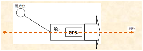
Marine Preprocess-Cable Length Correction (Pro)
Cable length correction, also known as towfish correction, is the correction method for eliminating the position errors between GPS and magnetometer. Horin Software has two kinds of correction methods: "Direct Algebra" and "Drag Algebra".
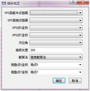
Cable length correction dialog
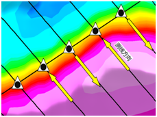
Heading Correction (Pro)
It is a method for solving the error from the different measurement values when the measurement platform passes the same point in different directions. The magnetic heading correction interface and effect as follows:
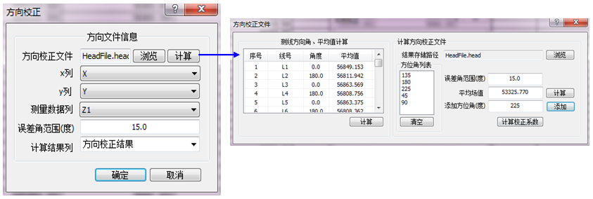
Heading correction interface
Before heading correction After heading correction
Lag correction (Pro)
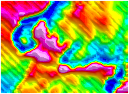
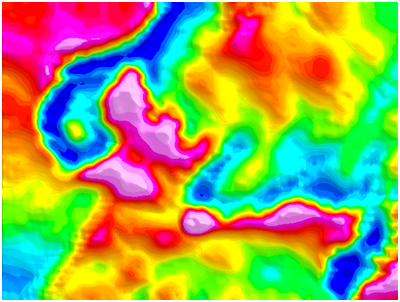
During field data sampling, due to the distance between the gravimeter / magnetometer and the GPS positioning probe,the GPS coordinate do not correspond to the really location of gravimeter / magnetometer readings, resulting in errors. Wrong zigzag appears at the edge between thehigh and low values in the map. Lag correction use for eliminate such errors.
Note: Lag correction is widely used in aerial surveys and ship surveys.
Lag correction diagram:
Instrument: ![]() GPS:
GPS: ![]()

Lag error Normal effect

Before lag correction After lag correction
版权所有:北京金浩林勘探技术有限公司 京ICP备12050676号
公司地址:北京市海淀区苏州街49号院7号楼610/616室 联系电话:010-62611285 服务投诉电话:13521903951 传 真:010-62611285 公司邮箱:sale@horinexplore.com
 Current Position:
  客服
客服